
 The sister mountaines Grosser and Kleiner Mythen (big and small Mythen) are the emblem of Kanton Schwyz and you can spot their distinctive summits from a lot of places in Schwyz. By the way, the country Switzerland (Schweiz) has its name from the aforementioned Kanton Schwyz. Although spelled differently in high German (Schweiz und Schwyz), the pronounciation can be somewhat similar in Swiss German.
Mythen, which has the same name as the German translation of legend, is named after the Latin “meta”, which means “something looming”.
The Grosser Mythen can be hiked by a steep path that starts in Brunni SZ (SZ is the abbreviation for Kanton Schwyz similar to the abbreviations used for the States in the US).
Checkliste time:
- Roundway: nope – you hike up the mountain and come down the same way
- Accessibility: By car, drive to Brunni SZ. There is a large parking place at the valley station of the cablecar.
- Length: 6 km and 800 hm
- Strenuousness: High. The path is very steep and narrow and you have to cover a lot of heightmeters. You should have a head for heights as well.
- View: Unique
- Loneliness: Nope, sorry.
- More information: Mythenweg (German only)
- When did I go there: June 2013
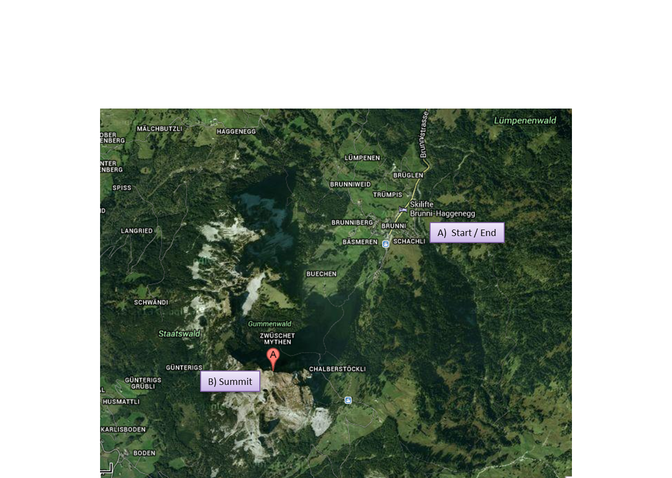 Here you see a very rough sketch on the trekking route (click for large image).
From Brunni, you can already see the impressive Mythen. Head into this direction (surprise…). Shortly after, you enter the forest and it already starts to get a little steep. If you want to cut some distance, take the cablecar to Holzegg. Leaving the forest, you will arive at Holzegg anyway. There is a small restaurant there that has a nice view and a toilet. Even though it is supposed to be just for guest, try to keep in mind that this is the only protected place where you can relieve yourself until you reach the summit.


After Holzegg, fun is over. The nice foresty path turns into steep Alpine gravel and rocks. Although the way is secured with chains at the most dangerous parts, take care. Most of the time, it’s rather narrow and it is a long way down. You will see dogs and even children on a leash to protect them from falling. Don’t be afraid though, as I said, the path is well-mended. Once the curvy part begings, have a look at the numbers in each curve. There are 43 curves going up Mythen and you can nicely stay updated on your progress. The view is beautiful and it might be a bit crowded at the week-ends. Most of the Swiss people have already been up Mythen and you get the impression it has become a kind of outdoor-pilgrimage. Even in June, there were small patches of snow near the peak.

And then, after an exhausting trip with many curves and much more heightmeters, you are there: the summit! There is a small restaurant at the top where you can enjoy a well-earned cold beverage – if you like to pay for it. Food and drinks are transported by heli to the summit and accordingly expensive. Here are some nice pics from the top:


Once you adequately enjoyed the great view and regained your breath, head down the way you came. We took the cablecar on the last part to give our knees your break. You might want to treat yourself with a very delicious ice coffee at the Restaurant Brunnialp. It contains large cones of coffee ice and a generous portion of cream. In addition, you can enjoy your ice coffee while marveling at the peak, which a) looks quite high from here and b) you know you just managed to walk all the way up. Feeling of success, yeah!


Pingback: Crossing the suspension bridge and a quick hike at Sattel-Hochstuckli | Spa and Travel